












South Sinai · Egypt
Where is Sharm El Sheikh, Egypt?
Sharm El Sheikh (شرم الشيخ) is at the southern tip of the Sinai Peninsula, where the Gulf of Aqaba meets the Red Sea. It is 495 km by road from Cairo (about 6 h 45 min by car).
At a glance
Where exactly is Sharm El Sheikh?
Sharm El Sheikh is at the southern tip of the Sinai Peninsula, where the Gulf of Aqaba meets the Red Sea, in the South Sinai Governorate (Sinai), at 27.9158°N, 34.3300°E. By road it is 495 km from Cairo (about 6 h 45 min); in a straight line the distance is 385 km. Because Sinai lies east of the Suez Canal, Sharm El Sheikh is geographically in Asia, although Egypt is an African country.
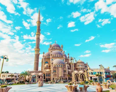
Sharm El Sheikh is famous for world-class diving and snorkelling in Ras Mohammed National Park and the Straits of Tiran, and for its resort area around Naama Bay.
How far is Sharm El Sheikh from other cities?
Road distances and realistic drive times for a private car, the straight-line distance, and the quickest way to travel from Sharm El Sheikh.
Hurghada is only 89 km away in a straight line, but the Gulf of Suez lies in between: by road it is 740 km (about 10 h 15 min) around the gulf. A direct flight takes about 55 min. The passenger ferry across the Red Sea has been suspended since 2020.
| To | By road | Drive | Straight line | Direct flight | Best way |
|---|---|---|---|---|---|
| Dahab | 92 km | 1 h 20 min | 68 km | — | By road |
| Saint Catherine | 205 km | 3 h | 80 km | — | By road |
| Cairo | 495 km | 6 h 45 min | 385 km | 1 h 5 min | Direct flight |
| Giza | 500 km | 6 h 45 min | 385 km | 1 h 5 min | Direct flight |
| Alexandria | 710 km | 9 h 15 min | 560 km | 1 h 25 min | Direct flight |
| El Gouna | 720 km | 10 h | 86 km | 55 min | Direct flight |
| Hurghada | 740 km | 10 h 15 min | 89 km | 55 min | Direct flight |
| Sahl Hasheesh | 760 km | 10 h 30 min | 100 km | 55 min | Direct flight |
| Makadi Bay | 775 km | 10 h 45 min | 110 km | 55 min | Direct flight |
| Soma Bay | 790 km | 11 h | 125 km | 55 min | Direct flight |
| Safaga | 795 km | 11 h | 135 km | 55 min | Direct flight |
| Luxor | 1,020 km | 13 h 45 min | 300 km | 1 h 15 min | Direct flight |
| Marsa Alam | 1,020 km | 13 h 45 min | 320 km | — | Fly via Cairo |
| Aswan | 1,230 km | 16 h 30 min | 450 km | — | Fly via Cairo |
| Abu Simbel | 1,495 km | 20 h 15 min | 675 km | — | Fly via Cairo |
Drive times are for a private car with one short stop; long-distance buses take roughly a third longer. Straight-line distances are measured between city centres. Road data © OpenStreetMap contributors.
How to get to Sharm El Sheikh
By air
Sharm El Sheikh International Airport (SSH) is 18 km from the centre, about 25 min by taxi or transfer. Direct flights from Cairo take about 1 h 5 min. Direct domestic flights also link it with Hurghada, Luxor and Alexandria. Direct international flights, many of them seasonal charters, arrive from Europe and the Middle East.
By road
From Cairo: 495 km, about 6 h 45 min by car, through the tunnel under the Suez Canal. Long-distance buses run daily from Cairo. Sinai roads have police checkpoints, so keep your passport with you.
Flights to Sharm El Sheikh International Airport from abroad
Typical non-stop flight times to Sharm El Sheikh International Airport (SSH). Where there is no direct service, most travellers connect in Cairo.
- Rome 3 h 45 min Direct
- Milan 4 h 5 min Direct
- Berlin 4 h 35 min Direct
- Moscow 4 h 50 min Direct
- Paris 4 h 50 min Direct
- London 5 h 20 min Direct
Via Cairo Athens, Istanbul, Vienna, Munich, Zurich, Frankfurt, Barcelona, Brussels, Amsterdam, Copenhagen, Madrid and Stockholm
- Amman 1 h 15 min Direct
- Dubai 3 h 55 min Direct
Via Cairo Beirut, Jeddah, Riyadh, Kuwait City, Bahrain, Doha, Abu Dhabi and Muscat
Via Cairo Mumbai, New York (JFK), Toronto, Beijing, Chicago, Seoul, Los Angeles, Tokyo and Sydney
Direct services to resort airports are often seasonal, and schedules change; check with the airline before booking.
Places near Sharm El Sheikh
Top tours & excursions in Sharm El Sheikh
Hand-picked, best-selling experiences in Sharm El Sheikh, with hotel pickup, instant confirmation and free cancellation.



Frequently asked questions
Where is Sharm El Sheikh located?
Sharm El Sheikh is at the southern tip of the Sinai Peninsula, where the Gulf of Aqaba meets the Red Sea, in the South Sinai Governorate of Egypt (Sinai), at 27.9158°N, 34.3300°E.
Is Sharm El Sheikh in Africa or Asia?
Sharm El Sheikh is in Asia. It lies on the Sinai Peninsula, the part of Egypt east of the Suez Canal, which is the usual boundary between Africa and Asia.
What is the nearest airport to Sharm El Sheikh?
Sharm El Sheikh International Airport (SSH), 18 km from the centre of Sharm El Sheikh, about 25 min by car.
How far is Sharm El Sheikh from Cairo?
Sharm El Sheikh is 495 km from Cairo by road, about 6 h 45 min by car, or 385 km in a straight line. A direct flight takes about 1 h 5 min.
How do you get from Sharm El Sheikh to Hurghada?
The quickest way is a direct flight, about 55 min, which runs a few times a week. By road it is 740 km around the Gulf of Suez, about 10 h 15 min. The passenger ferry across the Red Sea has been suspended since 2020.
What is Sharm El Sheikh famous for?
Sharm El Sheikh is famous for world-class diving and snorkelling in Ras Mohammed National Park and the Straits of Tiran, and for its resort area around Naama Bay.